Lake Tanganyika cichlids — species, locations & maps
Lake Tanganyika cichlids — species, locations & maps
tanganyika.si
Lake Tanganyika cichlids — species, locations & maps.
All images are used with permission of the authors. Unauthorized use is prohibited.
Quick links
Contact
© tanganyika.si
Between the rocky and sandy areas, aquatic vegetation develops, including Vallisneria, Myriophyllum spicatum, Hydrilla verticillata, and Chara spp. From depths of about six meters, rocky rubble transitions into extensive Chara fields, which may reach over one meter in height and extend toward open water, ending at depths between seven and twelve meters.
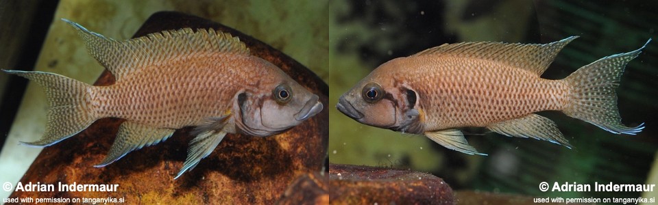
Gill-cover and head stripe patterns differ from typical N. savoryi and resemble traits known from N. pulcher, although individual variation occurs. Light blue fin margins, characteristic of N. pulcher, have also been observed.
Genetic investigations conducted within the framework of the ‘Cichlid-X’ Project indicate that this form is genetically distinct from N. savoryi, N. pulcher, and other members of the N. brichardi group, excluding its interpretation as a simple color variant. The population forms a closed reproductive community and occurs sympatrically with one presumed parent species, while remaining reproductively isolated. The evolutionary mechanisms maintaining this separation remain unresolved.
Photo gallery